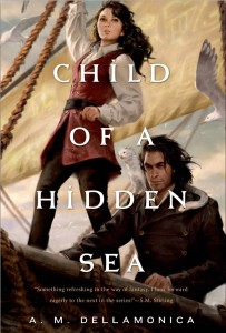
 Paul Weimer of SF Signal asks: Do I have a map for Child of a Hidden Sea
?
I must, right? You write a portal fantasy, and one of the perks must be that you get a gorgeous map, drawn by a professional, with Game of Thrones steampunky fabulousness and vast deserts and picturesquely named verdant forests, all populated by something way cooler than Ewoks.
This is one of my favorite kinds of question, because there are several answers, and some of them just about contradict each other.
Answer #1 – Yes! Stormwrack is the same size as Earth, though its orbital tilt and the length of its day are different. It takes 365 days to orbit its sun. Zero latitude and the international date line run through the great Verdanii city of Moscasipay, which is the home of something Wrackers call a World Clock. In more comprehensible terms, the Greenwich of this world is located on the same latitude as present-day Saskatoon.
I made the above choices because I wanted to be able to look at a map of our world and say “Okay, The Autumn District of Sylvanna is roughly where Tennessee is, and that means the sailing time from Moscasipay, in a ship moving at X speed, is Y days.” This makes things much easier for me, as someone who has some deficits in the map-reading area. It also fits with my having given Stormwrack many Earth-like qualities: the same gravity, tides, a similar ebb and flow of the seasons.
Answer #2 – No! There will be no actual map printed in Child of a Hidden Sea.
Why? Stormwrack is mostly ocean. The land there takes the form of small archipelagos of islands. They’re much like the Galapagos: little blobs of terrain, each with its own microclimate. The biggest land mass is, again, Verdanii, and that’s not even as big as Australia. So here’s the problem: a map of the whole world, printed at the size of even a double hardcover page, would be water, water, water and more water. Take a page of blue construction paper, sprinkle a pinch of basil on it, and you’ll get the idea.
Aha, you may be thinking, do a partial! Excellent point. Some months ago I had a conversation with my editor, Stacy Hague-Hill, about whether there could be a map of the region where Child of a Hidden Sea takes place. But Nightjar crosses from one archipelago to another in this book: Sophie visits Stele Island and then Erinth (the island where “The Ugly Woman of Castello di Putti” is set.) She sails from there to a place called Tallon and finally ends up hooking up with the Fleet of Nations, at sea. There are also a few stops in San Francisco.
In the second and third books, Sophie and Parrish spend a fair amount of time on Sylvanna, without so much zipping around, so maybe we’ll revisit the issue.
Another Yes! Of course I have an actual map of Stormwrack at home, laid out atop of a map of Earth, with pins marking important locations and saying which sea is which.
But also, No! Since I can’t draw, at all, the islands on the above-mentioned artifact look like someone pounded a bunch of Pop Rocks and blue-green wax crayons into some silly putty and threw it all into their microwave.
Finally, Yes and No–there are lies! I have a Gale story drafted, called “Island of the Giants.” In it, Parrish finds out that the official Fleet Maps of Stormwrack contain some politically motivated fibs. I don’t know yet when Sophie’s going to work that one out, but I promise she will be deeply unimpressed.
__________
Paul Weimer was kind enough to pitch me this question a couple of weeks ago when I started asking what all of you who read this blog might want to know, about me or the books or, really, anything.
Here’s the original request. I am still gratefully taking your questions.


